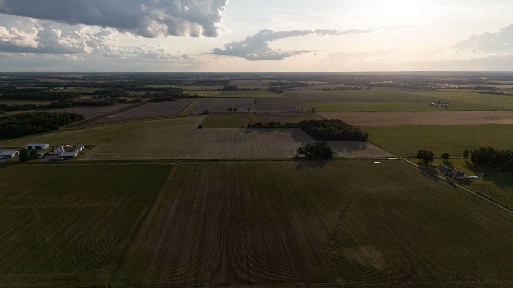
Pell City, Alabama · serving east-central Alabama
Your field is telling you something a month before you can see it
Crop health mapping, NDVI & NDRE imagery, orthomosaics, and variable-rate prescriptions — flown by an FAA-licensed pilot, back in your hands in 48 hours.
Published rates from $5/acre · No obligation, no mailing list
- FAA-Licensed Private PilotReal aviation training, not just a drone card
- M.S. Uncrewed Aircraft SystemsGraduate-level UAS engineering
- FAA Part 107 Remote PilotCertified for commercial drone operations
- Insured · Locally BasedLiability coverage · flying out of Pell City
What we fly today
Field intelligence, turned around in 48 hours
Four mapping services that answer the question every other input decision depends on: what is actually going on out there, and where exactly.
SVC 01
Crop Health Mapping
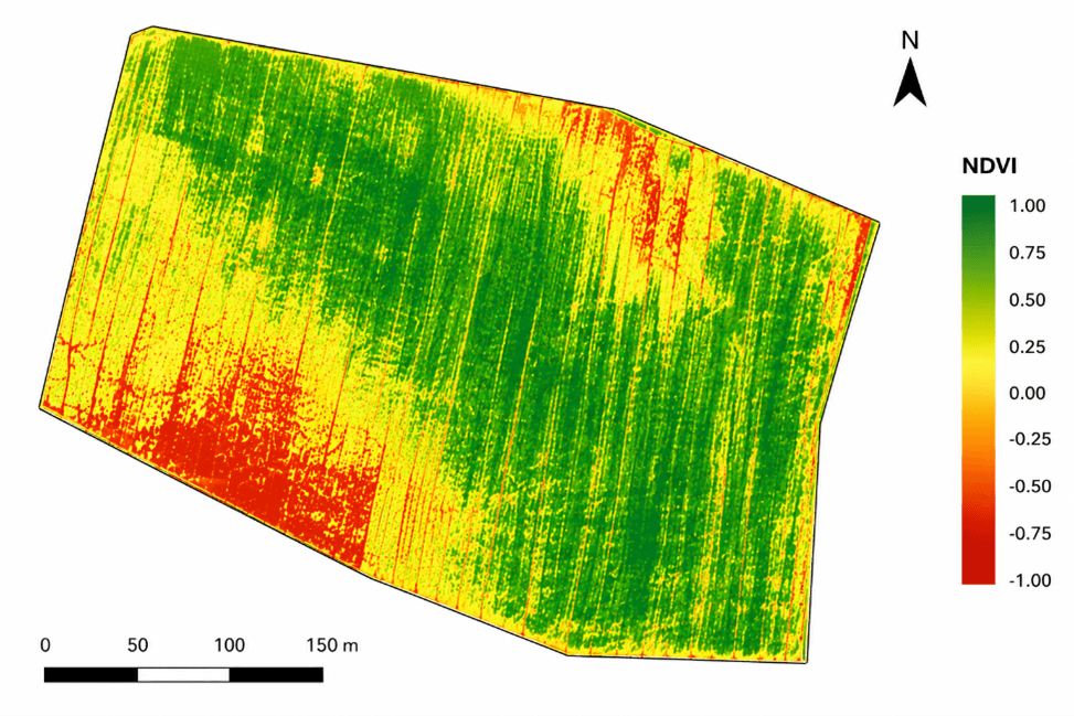
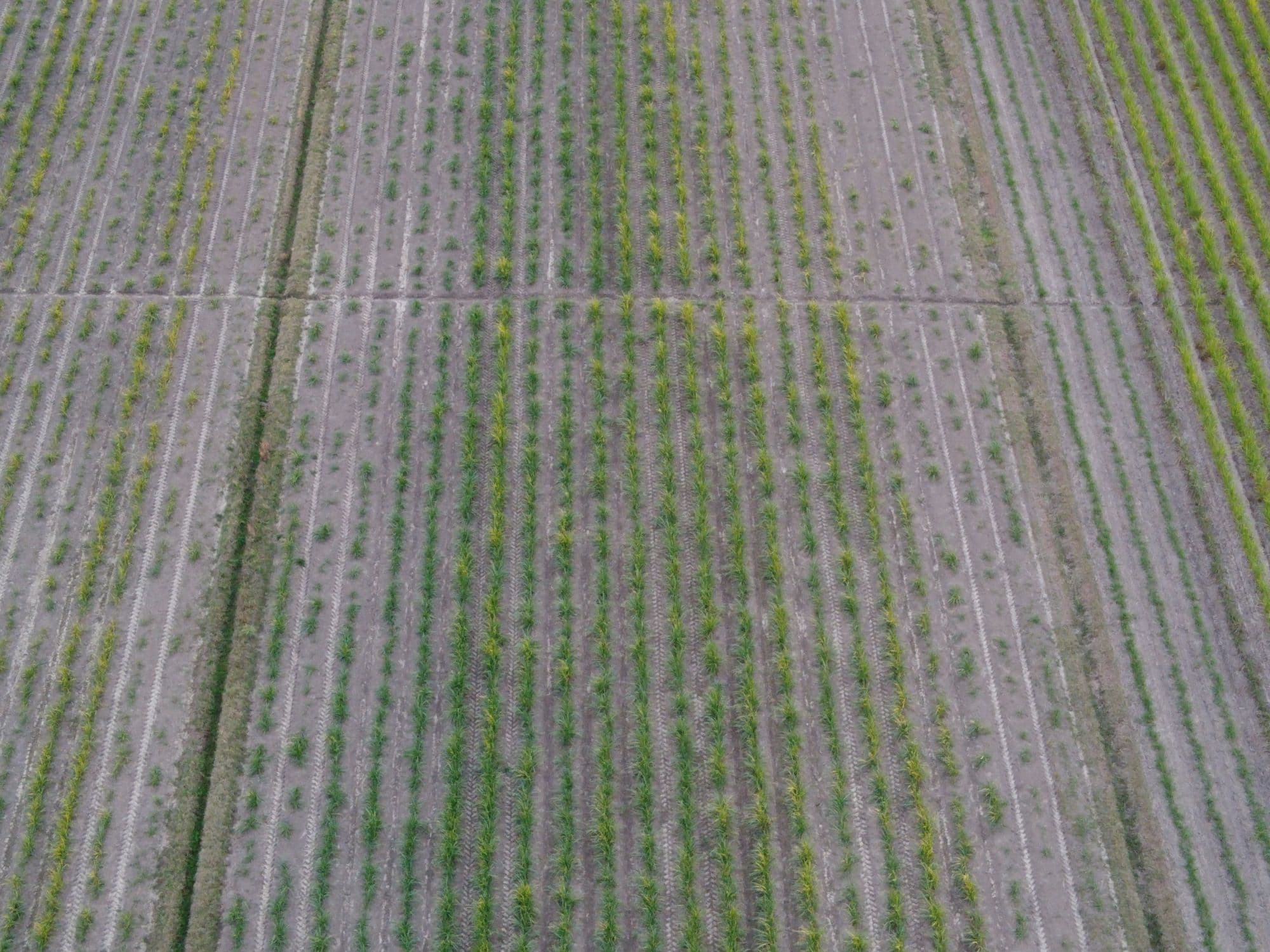
NDVI and NDRE imaging turns a 20-minute flight into a field-wide health map — no more walking hundreds of acres to find the problem spot.
SVC 02
RGB Mapping
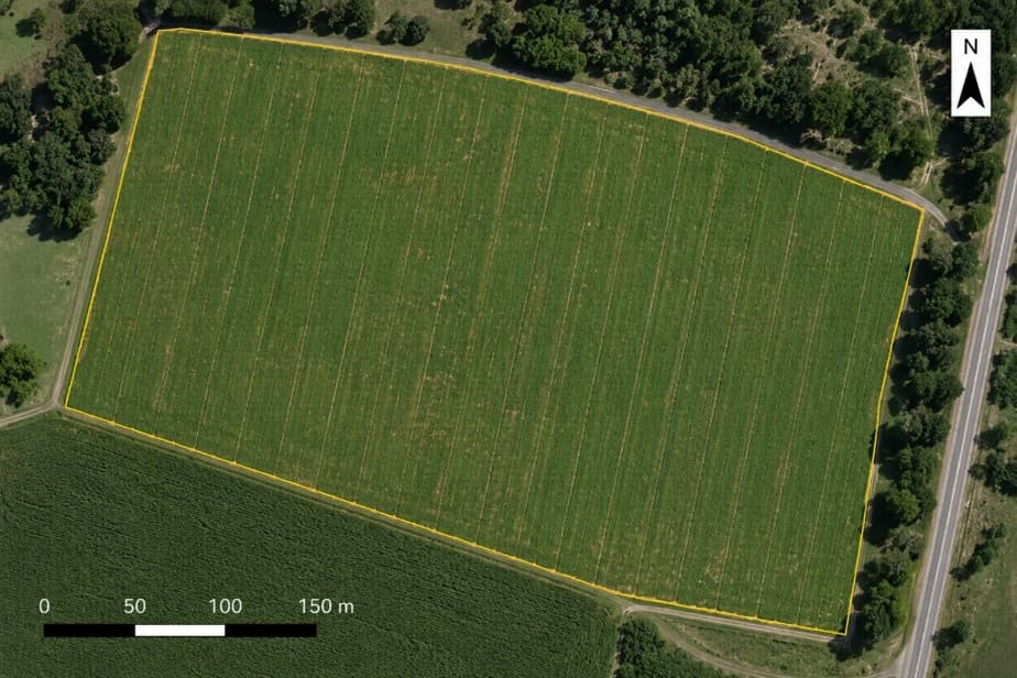
High-resolution stitched imagery of your fields — survey-grade enough to measure acreage, plan drainage, and document damage.
SVC 03
Prescription Maps
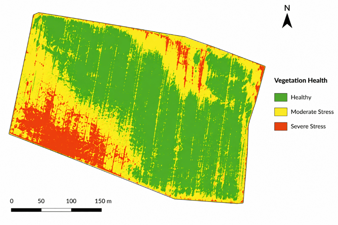
Management zones and variable-rate files built from your field's actual condition — compatible with John Deere, Trimble, AgLeader, and Climate FieldView.
SVC 04
Scouting Plans
Scheduled flights April through October with NDVI maps, annotated imagery, and flagged issues delivered to your phone. Like a scout that never misses a week.
- 4bands
- Multispectral + RGB capture
- ±10cm
- RTK positioning accuracy
- 48hrs
- Maps back in your inbox
- 9counties
- Served from Pell City
What lands in your inbox
Deliverables, not a data dump
A map you can't open is worth nothing. Here's exactly what comes back, in what format, and what it plugs into.
Every job includes
- Georeferenced index maps — NDVI, NDRE, others on request
- Management zones classified by stress level
- Full-resolution orthomosaic of the field
- A plain-English read on what the maps mean
File formats
- GeoTIFF — georeferenced raster
- Shapefile (.shp) and .kml — boundaries and zones
- PDF summary — the version you can hand someone
- Prescription files — .RX and controller formats
Opens directly in
- John Deere Operations Center
- Climate FieldView
- Trimble GFX / CFX
- AgLeader — or your agronomist's GIS
Everything stays in your client portal, season over season.
Why a drone
Made for east-central Alabama ground
This isn't Illinois. Our counties run to hillside pasture, hay ground, poultry country, and small row-crop bottoms — fields too small and too broken for satellites to say anything useful about.
Find the problem before it's visible
Stressed plants stop reflecting near-infrared long before they look bad to you. NDVI and NDRE imagery puts the bad spot on a map weeks ahead of the windshield — while there's still time to do something about it.
Stop walking fields to find a bad acre
A 20-minute flight covers what a morning on foot can't. You get the whole field at once, in one image, with the weak zones outlined instead of guessed at.
Data your equipment can actually execute
Maps that stay PDFs don't earn anything. We export .shp, .kml, and GeoTIFF plus prescription files for GreenStar, FieldView, Trimble, and AgLeader — so a zone map becomes a rate change on the next pass.
Built for small, broken, hilly ground
Satellite imagery is too coarse and too cloudy to help a 40-acre bottom between two ridges. We fly low, under the clouds, at sub-inch resolution — on exactly the fields the big services ignore.
Preflight to answers
How it works
First time hiring a drone? The whole thing takes three steps, and you never leave the truck.
- 1
Call it in
Tell us the field, the crop, the acreage, and what you're trying to figure out. You'll have a straight answer and a firm quote the same day — usually on the same call.
- 2
Flight plan
We draw your boundary, clear the airspace, and pick a window with the sun high and the wind down — the two things that decide whether the imagery is worth anything.
- 3
Maps in 48 hours
The flight takes about 20 minutes per 40 acres. Processed vigor maps, management zones, GIS files, and a plain-English read on what they mean land in your portal within two days.
◇ Next milestone
Aerial application is coming. It isn't here yet.
Spraying, spreading, and variable-rate application are the plan — and they require an FAA Part 137 agricultural aircraft operator certificate, an Alabama aerial applicator license, and the aircraft. We're working through it. Until every piece is signed, we won't quote application work or fly it.
Mapping customers hear about it first — and the field history we build for you between now and then is what makes the first application pass worth flying.
Instant estimate
What would your job run?
Vigor map, management zones, GIS files — analysis reports from $500
$400 – $640
Ballpark at $5–$8/acre. Firm quotes are free and take one call.
Service area
Based in Pell City, not boxed in by it
10 counties are the everyday zone — and the line isn't hard. Bigger jobs justify longer drives; Huntsville isn't out of the question.
Find your county
Outside these counties? For the right acreage we travel — ask us.
Ready to put a pilot on your fields?
Quotes are free, straight, and same-day. Tell us what you're up against.